Zeytinburnu District: A Brief History, Population, and Geographical Information
Zeytinburnu district is a historical district located in Istanbul, Turkey. The district was officially established in 1957 and covers an area of 11.42 square kilometers. According to the latest available census data from 2021, the district has a population of 293,839.
Zeytinburnu was the gateway of Istanbul to the West and Europe in the past as it is today. Due to this location, it was the meeting point of different cultures, languages and beliefs. It has always harboured a cosmopolitan demography.
Thanks to its flat topography parallel to the sea, it has managed to stay within the international transport network since time immemorial. Therefore, it has always been a centre of trade and attraction and has received intense migration in certain periods.
The most important transport route from the Romans to the Ottoman period passed through Zeytinburnu.
The Egnatia road, built by the Romans in the 2nd century BC and connecting the Adriatic to Istanbul, passed through Zeytinburnu. Approximately 1200 km long, the Egnatia road was an important branch of Rome’s giant transport network. It was also a powerful symbol of the empire’s dominance over the Balkans and Thrace. This route maintained its importance during the Ottoman period.
In the 5th century, very important religious and political buildings were built in the region.
By the 5th century, Zeytinburnu became one of the favourite settlements of the Byzantine Empire. In the second half of this century, Emperor Leo I had the Panayia Church and the adjacent Ayazma Balıklı built. Later, Emperor Iustinianos I repaired and expanded this church and some patriarch funerals have been buried here since then. Thus, the region gained importance for Christianity. By the 9th century, the Piyi Palace, built by Emperor Basileios I around the Ayazma of Balıklı, turned the area into a centre of attraction. In time, Ayazma and Çırpıcı Meadow became places where people came on holy days and fairs.
Fatih had the land walls extending between the Golden Horn and the Sea of Marmara reinforced with the Yedikule Fortress.
After Mehmed the Conqueror conquered Istanbul, he had the Yedikule Fortress built to reinforce the land walls between the Golden Horn and the Marmara Sea. Thus, the importance of Zeytinburnu increased even more. According to the legend, during the conquest of Istanbul, when there was a water shortage in the army, geese were seen flying in the sky. At the end of the researches made in the place where the geese were seen, a clean water source was discovered. In memory of this event, a fountain with a goose relief was built here. From that day on, the area is known as Kazlıçeşme.
From the 15th century onwards, the Kazlıçeşme area became the centre of tanneries, slaughterhouses and waxworks.
The Kazlıçeşme region was allocated to butcher and debbag tradesmen by Sultan Mehmed the Conqueror. In time, many large and small slaughterhouses and hundreds of tanneries were established here. Candle houses, where candles were made from the internal fat of slaughtered animals, also took their place in Kazlıçeşme. Thus, the region turned into an integrated production centre. In parallel with the economic vitality, the number of settlements in and around Kazlıçeşme increased.
Zeytinburnu became a typical Ottoman city with its orchards, masjids, lodges and dervish lodges, mevlevihanes and complexes.
After the conquest of Istanbul, Zeytinburnu transformed into a typical Ottoman settlement with its masjids, lodges and dervish lodges, mevlevihanes and complexes. Various vegetables were grown in the famous orchards along the land walls, and Istanbul’s vegetable needs were largely met from here. Outside the city walls was also a large cemetery area. These old Turkish cemeteries, where the martyrs of the Conquest were first buried, became an open-air museum with tombstones of high artistic value over time.
Zeytinburnu was planned as Kazlıçeşme Organised Industrial Zone and two of the heavy industrial zones were established in Zeytinburnu.
Zeytinburnu witnessed every step of the Ottoman industrialisation process in the 19th century. In addition to the traditional tanneries, iron, steel, mavzer-flare, lightning, chemical and weaving factories were established with new technology. Zeytinburnu also underwent a rapid change during the Republican period. It was planned as Kazlıçeşme Organised Industrial Zone by Istanbul Municipality in 1947 and two of the heavy industrial zones were established in Zeytinburnu. Along with industrialisation, Zeytinburnu became acquainted with the phenomenon of rural-urban migration, and subsequently with shantytowns.
Zeytinburnu was elevated to district status in 1957.
With the increasing population, Zeytinburnu was raised to district status in 1957. In the 1990s, the social structure of the district changed as apartment buildings replaced the slums. Towards the end of these years, the ZEYPORT port project was implemented. The district, which entered the 2000s in search of a new identity, took on a brand new face with urban transformation projects, infrastructure works, landscaping and transport investments in these years. Particular emphasis was placed on municipal services that prioritise the cultural and social development of the residents of the district.
Today, Zeytinburnu is one of the leading cultural and faith tourism centres of Istanbul with its historical texture and local values.
All these efforts have begun to bear fruit, and today Zeytinburnu is one of the leading cultural and religious tourism destinations of Istanbul with its polished historical texture and local values.
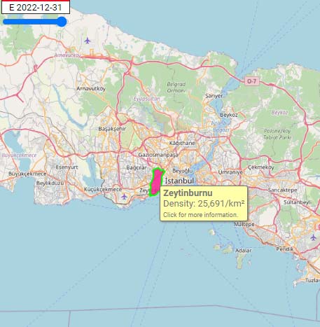
292,616 Population [2022] – Estimate
11.39 km² Area
25,691/km² Population Density [2022]
0.36% Annual Population Change [2017 → 2022]